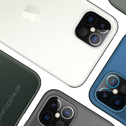
LiDAR Scanning Technology:- iPhone 12
Apple’s LiDAR Scanner in iPhone 12
What is LiDAR technology?
Lidar, which stands for Light Detection and Ranging, is a remotesensing method that uses light in the form of a pulsed laser to measure ranges (variable distances) to the Earth. These light pulses combined with other data recorded by the airborne system generate precise, three-dimensional information about the shape of the Earth and its surface characteristics.
A lidar
instrument principally consists of a laser, a scanner, and a specialized GPS
receiver. Airplanes and helicopters are the most commonly used platforms for
acquiring lidar data over broad areas. Two types of lidar are topographic and
bathymetric. Topographic lidar typically uses a near-infrared laser to map the
land, while bathymetric lidar uses water-penetrating green light to also
measure seafloor and riverbed elevations.
Apple’s lidar SCANNER!!!
LiDAR, in general, stands for ‘Light
Detection and Ranging’ – is a well-known technology in the geospatial industry as a
revolutionary tool for scanning and surveying. LiDAR enables detection of
objects and builds 3D maps of surroundings in near real-time, allowing the user
to see objects as they are.
Apple’s LiDAR Scanner is not at the level of
professional LiDAR scanners (as that available for outdoor surveying and
scanning) –yet it can measure the distance to surrounding objects for
approximately 5 meters away, works both indoors and outdoors, at a photon level
at nanosecond speed, and enables tracking the location of people (spatial
tracking). The advantage of the LiDAR Scanner is that it shall fit in smaller
and provide complete access to lower and confined areas, where fitting in
large-scale scans is difficult – necessary for precise surveying.
Apple’s LiDAR Scanner – Applications
Over the last month, the use of the LiDAR Scanner on the iPad Pro model has been under discussion. While the naysayers –do find the current use of LiDAR Scanner to be limited; in its capacity, the LiDAR Scanner and the AR experiences are suited to work best in indoor and confined environments and for short travel distances (5 meters). The LiDAR Scanner can accurately create a 3D map and model of a home in minutes (augmented by other AR apps).
Scan data from the LiDAR Scanner, the image data from camera’s and motion data from the arrays of sensors on iPad Pro – simplifies the construction of accurate and precise spatial maps of the confined and indoor environment in nanoseconds. – Apple’s LiDAR Scanner provides for a robust and accurate 3D scanning and measuring device (primarily when used with Measure App) – delivering for 3D mapping, and measuring of interior spaces, object identification and classification. Apple LiDAR Scanner is a solution to the growing demand for mobile scanning in short/indoor and complex environments; and may also be extended to confined outdoor industrial sites.


Comments
Post a Comment